SPM Geosolutions helps organisations process technical data, build useful spatial systems, communicate evidence clearly, and develop the people who use them.
Our public offer is organised around specific client needs and useful deliverables—not broad technical labels. A project may involve one service or a connected combination of processing, systems, analysis and training.
Every engagement is scoped around the available data, users, operating context, professional responsibilities and intended outcome.

Additional technical capacity for survey and engineering firms that need help moving from field data to checked, deliverable-ready outputs.
Licensed survey and engineering firms
Topographic and cadastral data processing
Engineering survey and field-data workflows
Processing review and quality checks
White-label delivery where agreed
Client value: Clear backlogs, protect deadlines, and take on more work without immediately increasing permanent office overhead.

Technical processing support for specialised datasets that require appropriate software, workflows, quality checks and agreed final formats.
Survey, infrastructure, environment and project teams
Point-cloud processing and classification
Orthomosaics, DSMs, DTMs and terrain products
Photogrammetric and remote-sensing outputs
Bathymetric processing and technical reporting
Client value: Use specialist data with greater confidence and receive outputs that fit the next stage of design, analysis or reporting.

Structured spatial databases for organizations that need reliable records, controlled updates, repeatable queries and a shared source of information.
Government, utilities, institutions, NGOs and project teams
Spatial data model and database design
PostgreSQL and PostGIS implementation
Data cleaning, migration and population
Permissions, maintenance guidance and documentation
Client value: Replace scattered files and repeated manual consolidation with information that is easier to find, update and manage.
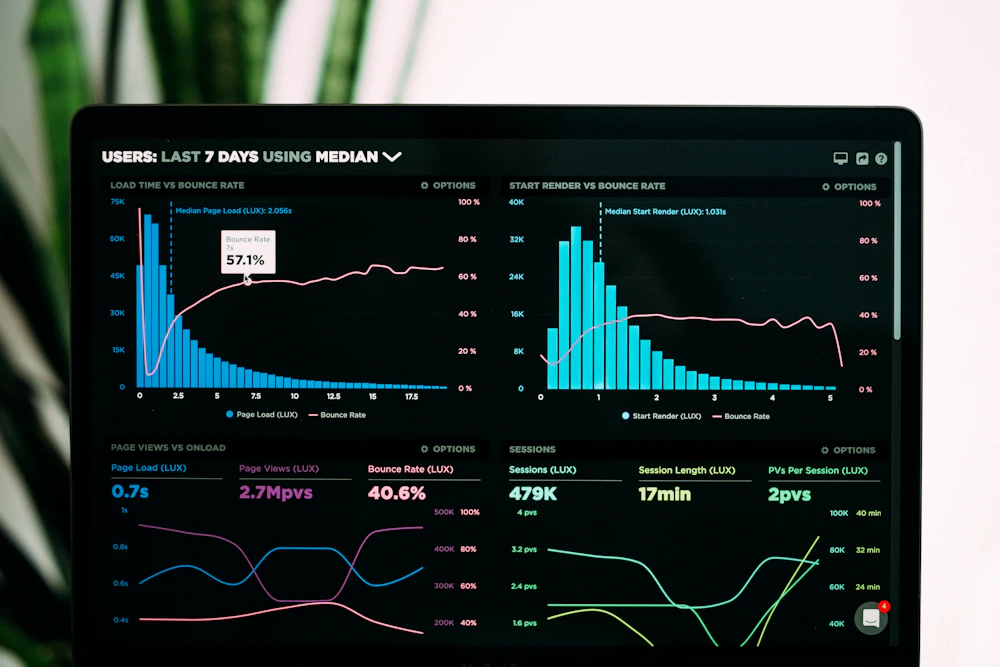
Practical systems that connect spatial databases, maps, field updates and reporting so teams can see what is happening and where.
Project managers, public programmes, utilities, contractors and NGOs
Interactive web maps and configured layers
Dashboards, charts and performance indicators
Status maps, issue registers and user roles
Deployment guidance, training and support
Client value: Improve visibility, identify issues earlier and reduce dependence on disconnected spreadsheets and late manual reports.

Digital field forms that capture required attributes, locations, photographs and validation rules at the source.
Utilities, government, NGOs, inspectors and research teams
Configured mobile forms and form logic
GPS capture, photographs and validation
Offline workflows where appropriate
Synchronization, dashboards and field guides
Client value: Capture cleaner information once, reduce re-entry and follow-up calls, and speed up reporting from distributed teams.

Connected maps, records, documents, inspections and workflows for land, facilities, infrastructure and utility assets.
Land agencies, municipalities, utilities and infrastructure owners
Parcel, asset or network maps
Document links and inspection history
Status workflows and user permissions
Operational dashboards and handover plans
Client value: Strengthen control of assets and land, support maintenance planning and reduce dependence on individual staff members.

Spatial evidence turned into clear comparisons, patterns and decision support for planning, targeting, risk management and feasibility work.
Government, planners, agriculture, environment, infrastructure and investors
Suitability, risk and accessibility analysis
Terrain, hydrology and network analysis
Remote-sensing classification and change detection
Technical maps, results and interpretation reports
Client value: Move from large datasets and imagery to a clear basis for prioritisation, targeting and resource allocation.

Clear, audience-focused maps and visual products for reports, publications, field operations, public communication and decision-makers.
Consultants, government, NGOs, researchers and project teams
Thematic, reference and topographic maps
Report maps, atlases and map templates
Large-format and web-optimised outputs
Visualisation guidance and quality review
Client value: Make technical findings easier to understand and help stakeholders act on the information.

Equipment- and project-based learning that connects planning, fieldwork, processing, quality checking and final presentation.
Professionals, graduates, universities, firms, government and NGOs
QGIS, ArcGIS Pro, Web GIS and spatial databases
GNSS, total stations and levels
Programming, remote sensing and field workflows
Drones, LiDAR, photogrammetry, bathymetry and utility mapping
Client value: Build job-ready capability, improve equipment and software adoption, and help junior teams become productive faster.
We can begin with a small, clearly defined need or structure a longer technical partnership as your workload and system mature.
01
A defined dataset, workflow or deliverable with agreed inputs, outputs, assumptions and schedule.
02
A retainer for firms that need defined production hours, priority scheduling and agreed turnaround targets.
03
A focused assessment or one high-value use case used to prove value before a wider rollout.
04
A structured cohort or institutional programme built around realistic tasks and assessed outputs.
We make responsibilities, assumptions, review stages and handover visible so clients know what is being delivered and how to continue using it.
Clear scope and assumptions
Visible QA and review stages
Qualified responsibility
Secure data transfer and handling
Progress communication
Useful handover and support
Share your project context, available data and intended outcome. We will help identify the right service or combination of services.